| Day 1 | Arrival in Santa Marta
Santa Marta is a coastal city in northern Colombia, located on the Caribbean Sea. It is one of the oldest cities in South America, founded in 1525, and serves as a gateway to stunning natural and cultural attractions. Surrounded by the Sierra Nevada mountains and tropical beaches, Santa Marta offers access to Tayrona National Natural Park, indigenous communities, and historical sites such as the Quinta de San Pedro Alejandrino, where Simón Bolívar spent his last days. The city blends colonial heritage with Afro-Caribbean and Indigenous cultures, creating a rich and authentic travel experience. Arrival and transfer to a hotel located in downtown. Briefing in the afternoon/night with the mountain guide, about the trip´s program and logistics.
Included meals: None |
| Day 2 | Muñkuawinaka (500m) – Santana (800 m)
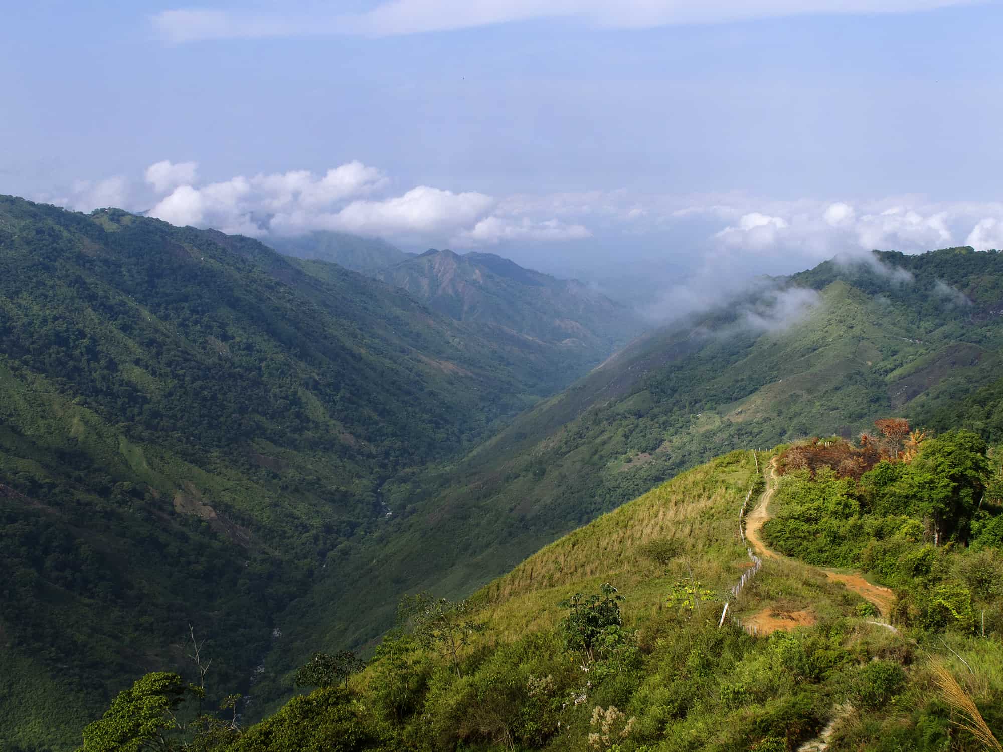
Very early departure from Santa Marta, heading south and then east up on the Eastern flank of the Sierra Nevada de Santa Marta. The road trip to the the Kogi settlement of Muñkuawinaka takes about 4 hours, depending on the road’s conditions. Muñkuawinaka (500 m), also known as La Esperanza, is a small agricultural town located on the lower Mamarongo River valley and the trailhead to this adventure. Here the group will meet the rest of the staff and the horsemen.
The hike follows a very well marked trail that progresuvely ascents by the river margins along the Kogi indigenous territory. Temperatures are quite high and the river’s breeze is welcome. After about 4-5 hours walk, the team will reach a local Kogi farm know by the name of Santana (800 m), the first campsite. This place is very iconic, due to the junction between the River Valles of Mamarongo and Namgexa (Tucurinca)
Night in tents.
Ascent: 300 m / Highest Altitude: 800 m / Activity duration: 4-5 h
Included meals: Breakfast, Picnic, Dinner |
| Day 3 | Aldusabagui (1602 m)
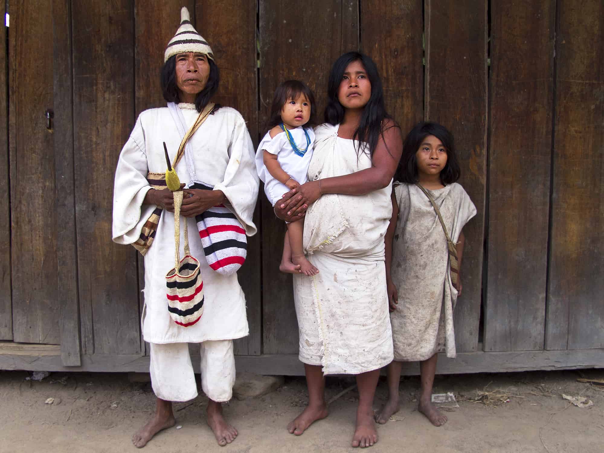
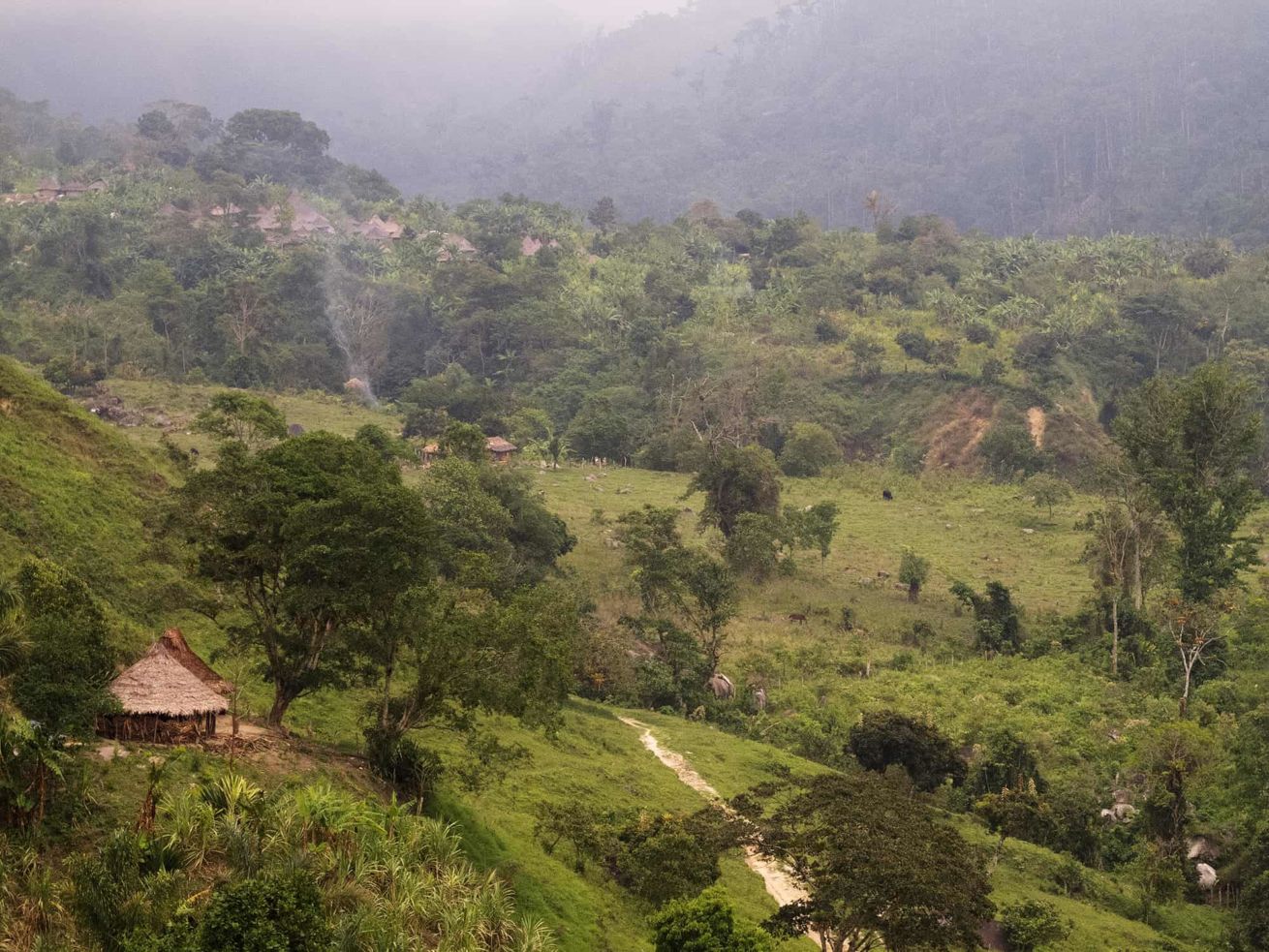
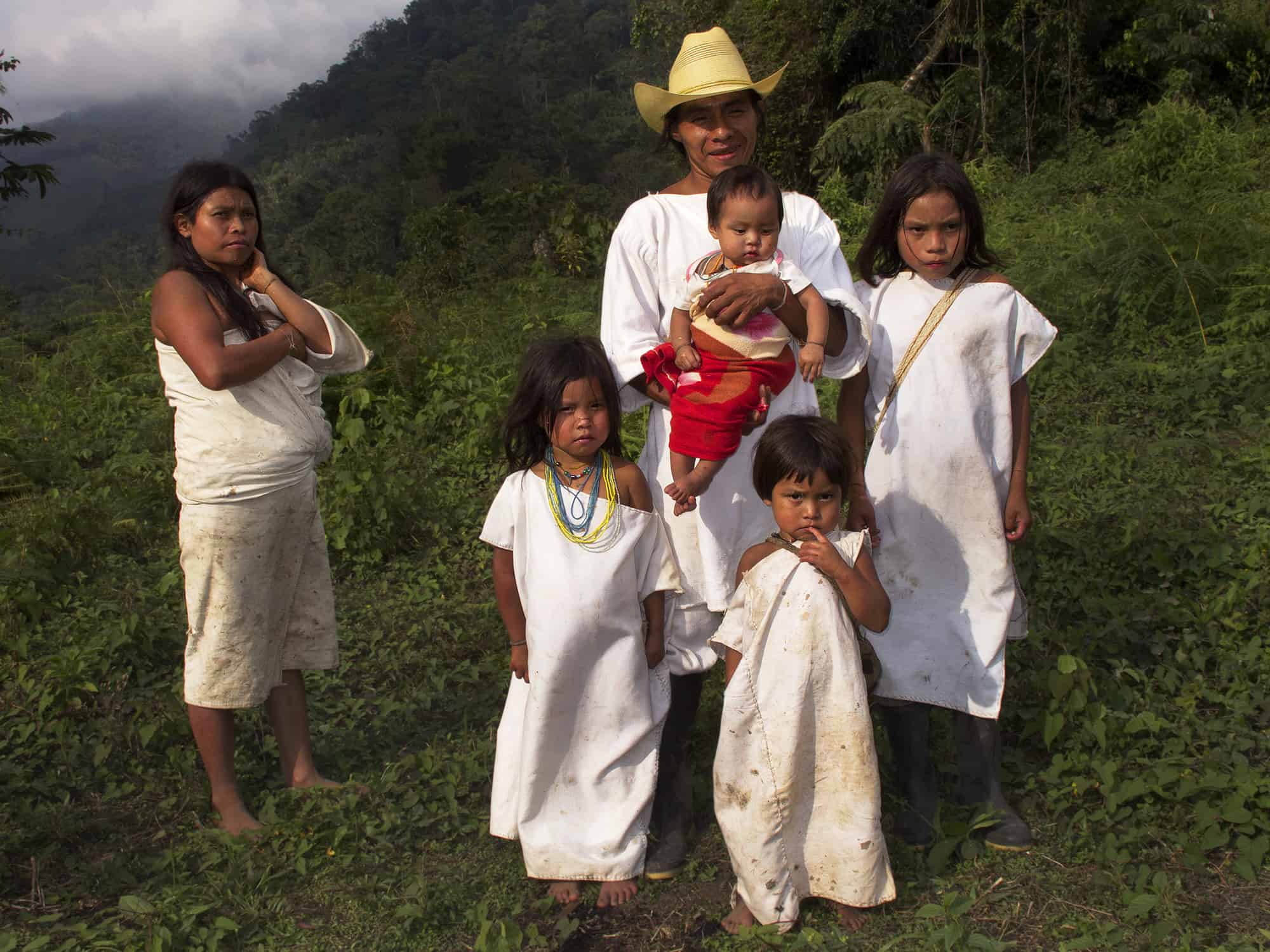
Today the hike will continue ascending by the Namgexa (Tucurinca) Valley for around 4-5 hours passing the kogi settlement of Mankuxa. This is a very nice hike through tropical forest, passing indigenous farms, until the main settlement of Aldusabagui (Mamarongo) which has about 85 families living permanently. Aldusabagui is the most important town in the valley and the place where both the civil and religious authorities are located.
The group will spend the afternoon in the town experiencing the local life and this beautiful spot.
Night in tents.
Ascent: 802 m / Highest Altitude: 1602 m / Distance 15,6 Km / Activity duration: 4-5 h
Included meals: Breakfast, Picnic, Dinner |
| Day 4 | Sianeizhi (2750 m)
Time to leave Aldusabagui and begin the trip to the highlands. The hike starts through an agricultural area with diverse crops and some few animals, slowly ascending into a pasture area known as Uramka, close to the Platanilla Waterfall. The trail goes on the left margin of the Namgexa River and through changing vegetation as altitude is gained. The day’s goal is the site of Sianeizhi (2750 m), located at the foot of the Cerro Cienaga Mountain, which is one of the holiest places in the Namxega valley and where the important meetings of the local shamans (Mamos) take place.
Night in tent.
Ascent: 1148 m / Highest Altitude: 2750 m / Distance 9,7 Km / Activity duration: 7-8 h
Included meals: Breakfast, Picnic, Dinner |
| Day 5 | Dibuñgui (3604 m)
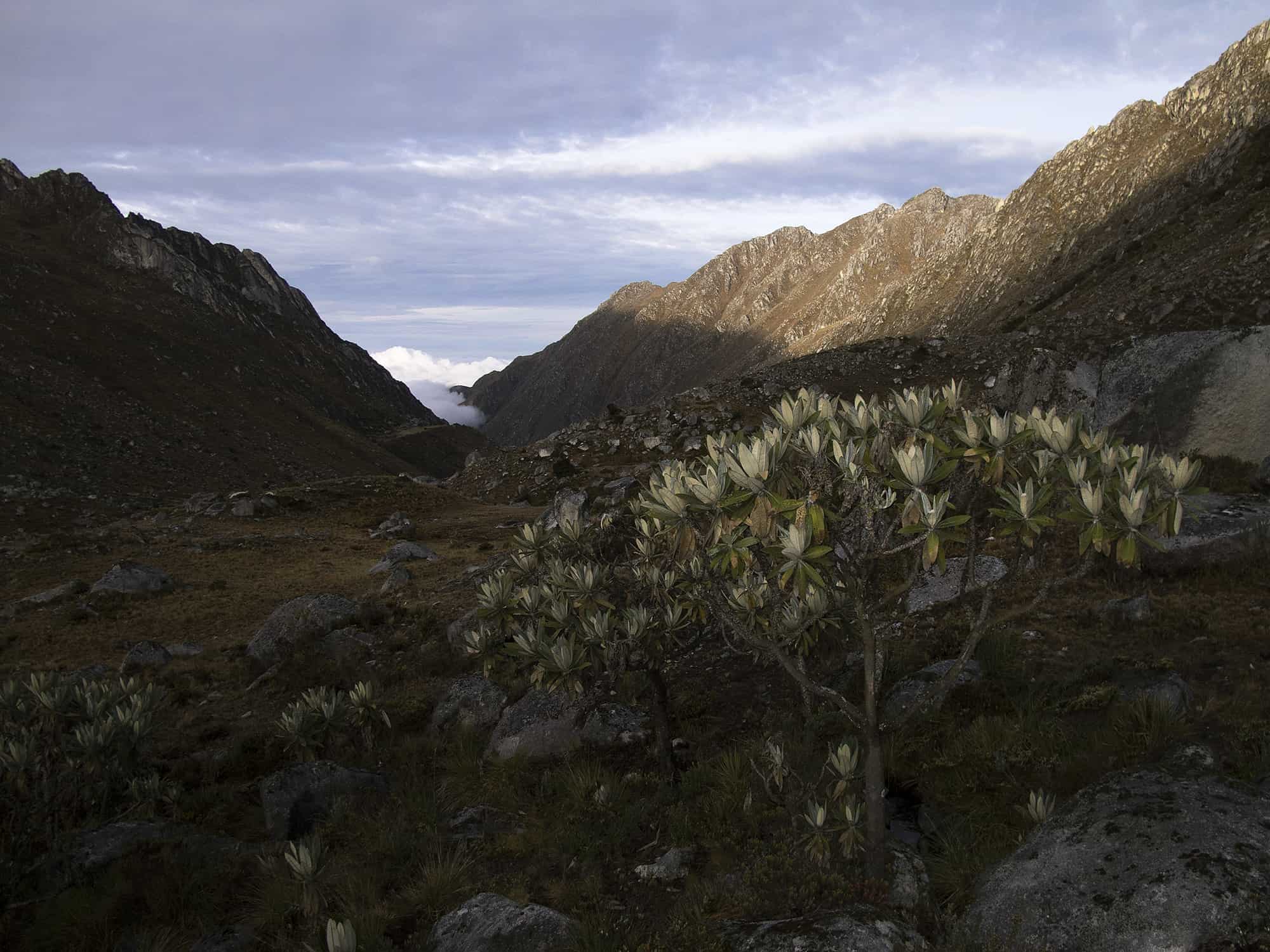
After a night in this lovely location, the team will continue up the Namgexa valley. Now the trail goes higher than the river and the landscapes opens up, as the palm and bamboo forest are left below. The “sub-paramo” (Colombia’s highlands) low vegetation begins to appear with the endemic “Frailejon” tree, which is only found in this mountain range and belongs to the family of Espeletia, locally known as “Frailejones”, but this one is a tree-like, different from the ones in the Andes.
In the distance and high on the valley ridges, the moraines begin to appear and the temperature is clearly lower than previous days.
After while on the “Sub-paramo” area, a couple of indigenous hut will show up and that is where the next camp will be established. These huts are known as: Dibuñgui.
Night in tents.
Ascent: 854 m / Highest Altitude: 3604 m / Distance 8,2 Km / Activity duration: 5-6 h
Included meals: Breakfast, Picnic, Dinner |
| Day 6 | Dibuñgui – Rest day
Today will be a rest and acclimatization day, before hiking into the highlands. It is possible to do a short hike to one of the many lakes and ridges around the camp to improve the acclimatization.
Night in tent.
Included meals: Breakfast, Picnic, Dinner |
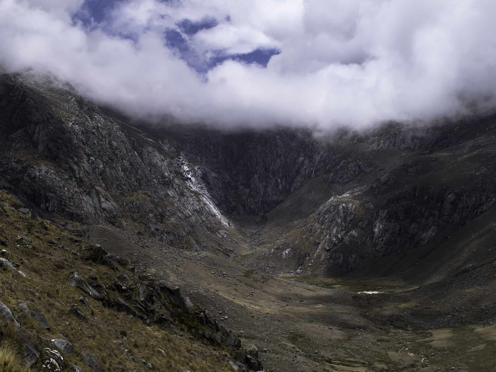
| Day 7 | Carcuinna/Nautanedan Lake (4433 m)
Departure after breakfast ascending by the upper Namgexa Valley, known as Quebrada Viscungue, towards an impressive rocky area that kind of “closes” the valley. From the valley’s floor, the ascent is quite steep through a grass section until reaching the top of the rocky area, then follow the river to the beautiful blue lake of Arucuina (4223 M), which is surrounded by yellow/gray granite slabs and sandy beaches. From here the trail gains altitude and crosses a couple of passes, from where is possible to get the first sights of the snowy summits of Simmonds and Ruiz Erazo on clear days. After a last ascent, the shores of Carcuinna/Nautaneda Lake will appear and the next camping site.
Night in tent.
Ascent: 829 m / Highest Altitude: 4433 m / Distance 5,8 Km / Activity duration: 4-5 h
Included meals: Breakfast, Picnic, Dinner |
| Day 8 | Base camp (4889 m)
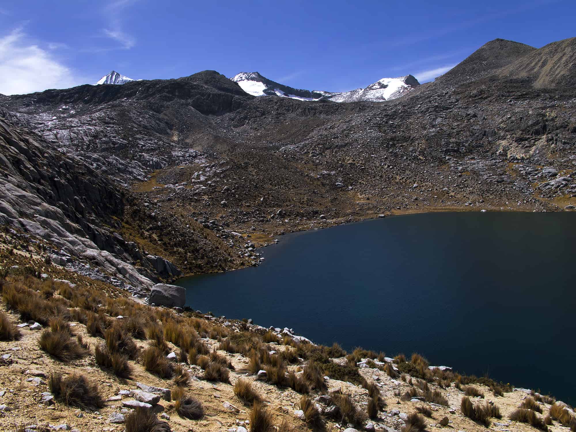
On clear mornings, Nautaneda campsite has a great view to the peaks with the lake in the foreground, all in an alpine atmosphere!
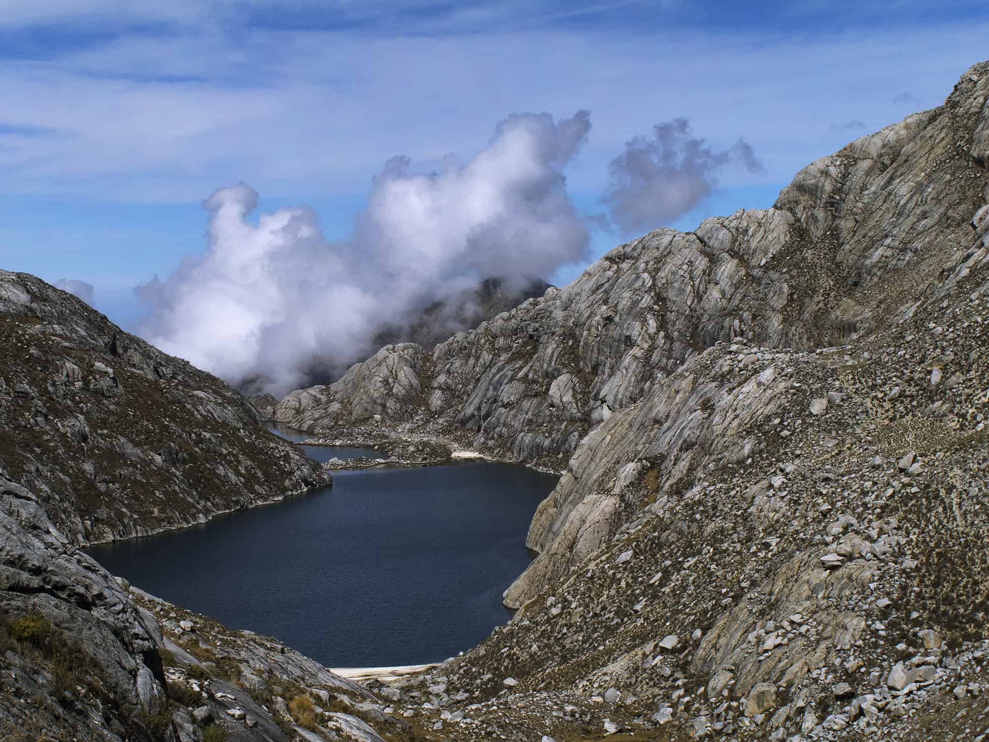
Today’s activity is one of the shortest but very important to walk slow and gain little altitude due the high elevation from the previous day. The hike follows a wide valley, passing some sandy sections between the moraine and granite slabs. On the path, there will be 2 lakes along the way before reaching the last one, where the base camp is located.
It is a very nice day with excellent views and fantastic landscapes to hike in.
Night in tent.
Ascent: 456 m / Highest Altitude: 4889 m / Distance 4,3 Km / Activity duration: 3-4 h
Included meals: Breakfast, Picnic, Dinner |
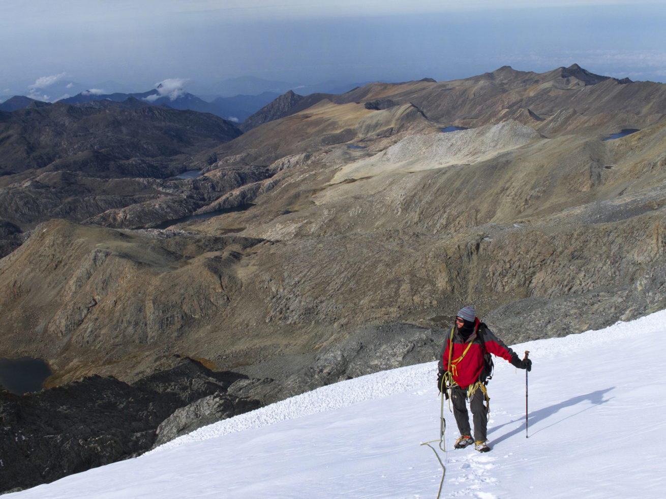
| Day 9 | Climb: Shugui (Pico Ruiz-Wilches) 5290 m
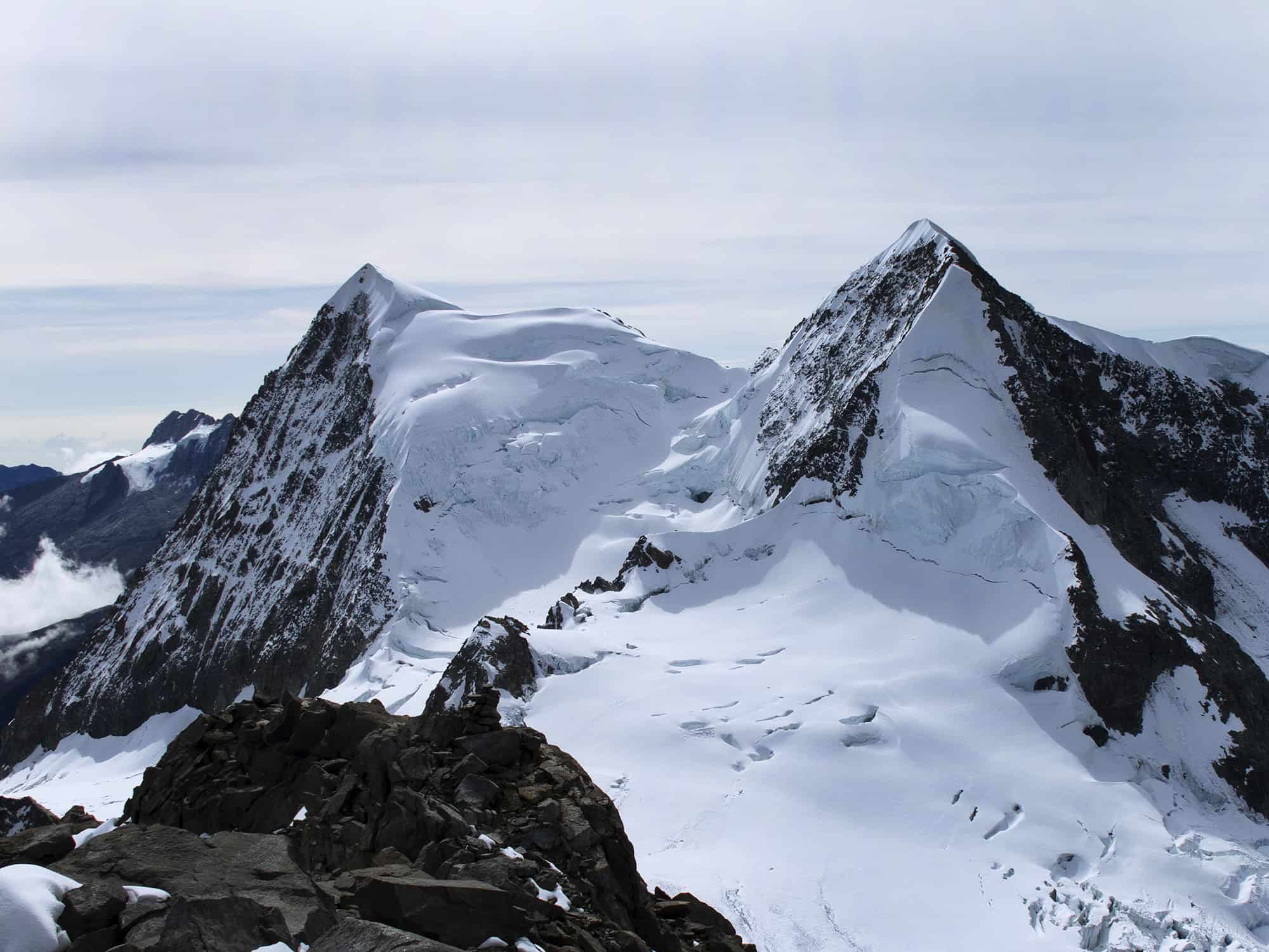
After a relaxing morning, the team will head out to climb the first peak of the program: Shugui. Leave base camp, hiking by the right margin of the lake until the base of the mountain. From this point, few trail’s marks lead the way up to the Eastern ridge, which goes all the way to the summit. This peak has one of the best panoramic views over to the highest summits of Colombia: Pico Colon (5780 m) and Bolivar (5775 m) and their impressive north faces. Also a fantastic sight down to the Caribbean coast and across a deep gorge to the next program’s summit: Nabuldue (Pico Simmonds) 5625 m.
Definitely a place not to be missed!
On the afternoon briefing and preparations for the next objective.
Night in tent.
Ascent: 401 m / Descent 401 / Highest Altitude: 5290 m / Distance one-way 1,7 Km / Activity duration: 3-4 h
Included meals: Breakfast, Picnic, Dinner |
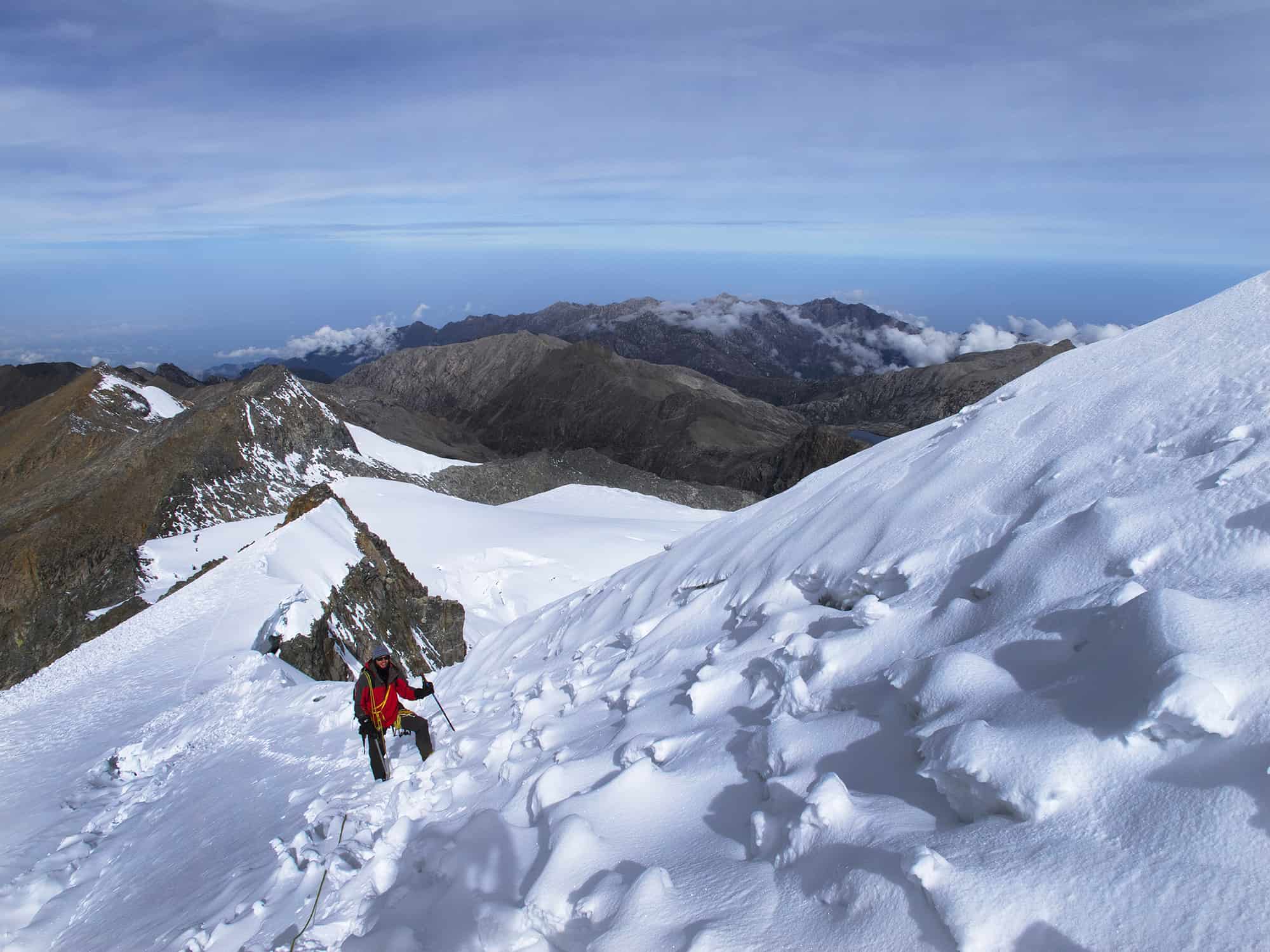
| Day 10 | Climb: Nabuldue (Pico Simmonds) 5625 m
The team will be call around 2 AM for breakfast and to start the hike around 3 AM. First par of the way, is the same as on the previous day peak, but it turns East over a short mountain pass at the edge of a gorge that divides Simmonds from Ruiz-Wilches peaks. After descending to the gorge, the trail passes by several small glacier lakes and climbs a triangular series of slabs up to the glacier’s edge. The team will gear up and have a bite before heading into the glacier. The first section is a bit steep until reaching the glacier’s ridge, once on top of it the ascent eases out and the view is just great. The glacier is quite long and there are a few crevasses to be negotiated. At the end of the long traverse, there is a rock band that divides the big lower glacier from a minor upper one, which lead to the final summit rock pyramid. By the rock band, the sun will be rising and there a 360º view all around the mountain, over to the high plateau, several valleys and down to the north the Caribbean coast. To the west, in the distant horizon, the eastern summits of Tayrona, Guardian, La Reina and El Ojeda can be seen on clear days.
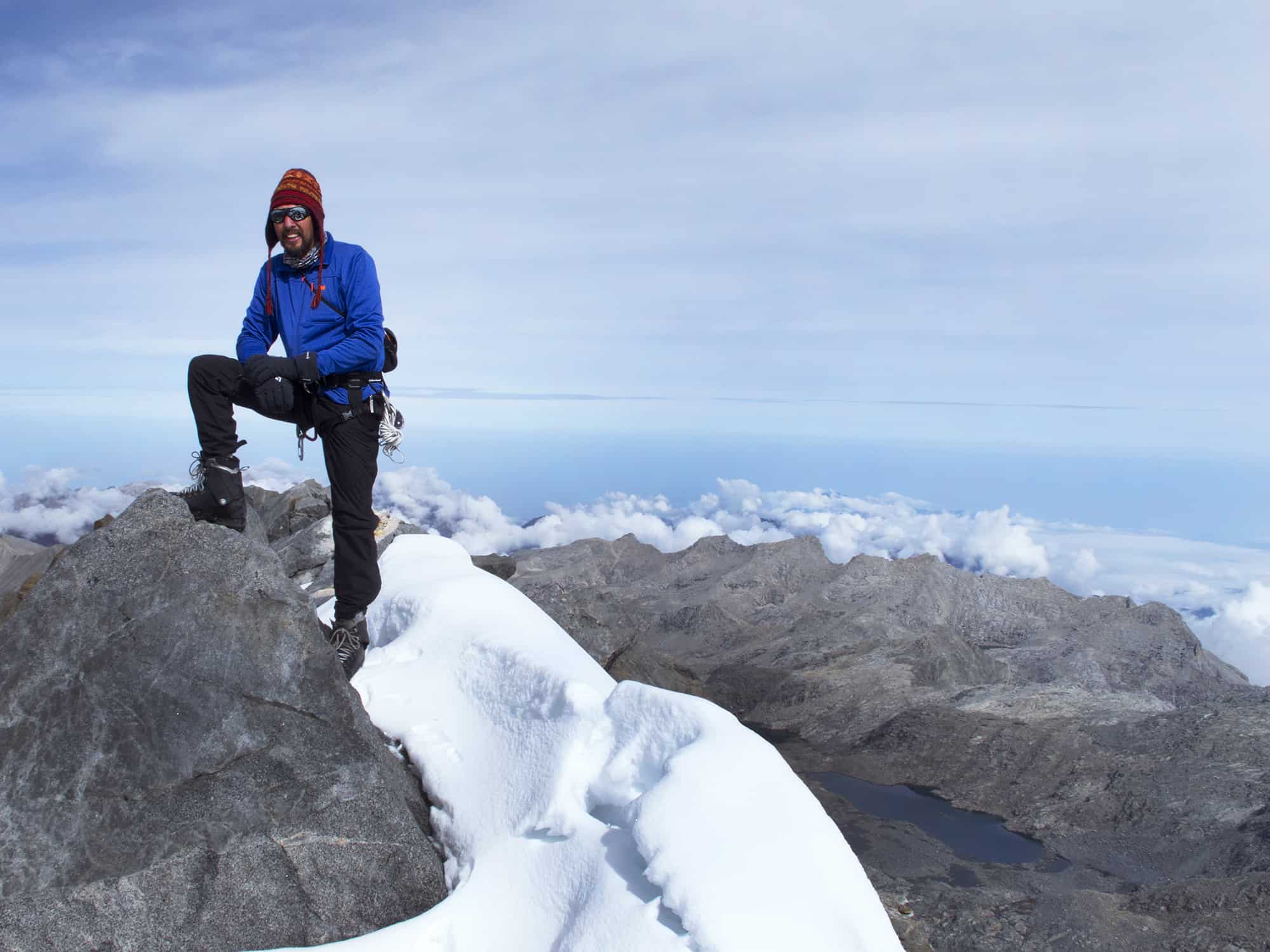
From the rock band, the terrain is not difficult but the altitude can be felt, while walking along the ridge until the rocky section that leads to the summit. The last 100 meters’ scrambling is easy and really fun and it ends right at the main summit 5625 meters. Right in front the Pico Colon, Pico Bolivar and Pico Santander stand out with their impressive glaciers and alpine terrains. To the East the Ruiz-Wilches peak and the base camp lake below.
The descents follows the same trail back to base camp. Upon arrival, a good lunch will be waiting and the rest of the evening to recover and enjoy the sunset over the mountain.
Night in tent.
Ascent: 736 m / Descent 736 / Highest Altitude: 5625 m / Distance one-way 3,8 Km / Activity duration: 8-10 h
Included meals: Breakfast, Picnic, Dinner |
| Day 11 | Dibuñgui (3604 m)
Relaxing morning and breakfast at base camp. After finishing packing the camp up, the team will head back down to the upper Tucurinca valley, passing 4 major lakes along the way. Today the vegetation and temperature change is noticeable and the hike very enjoyable. Upon arrival in Dibuñgui, there will be good time to rest.
Night in tent.
Descent 1285 m / Highest Altitude: 4889 m / Distance 10,1 Km / Activity duration: 5 h
Included meals: Breakfast, Picnic, Dinner |
| Day 12 | Aldusabagui (1602 m)
Early morning departure down the Namxega River valley, passing the sacred site of Niycuma, Uramake campsite and Cocotama before reaching the settlement of Aldusabagui.
Night in tent.
Descent 2002 m / Highest Altitude: 3604 m / Distance 10,1 Km / Activity duration: 7 h
Included meals: Breakfast, Picnic, Dinner |
| Day 13 | Muñkuawinaka (500m) – Santa Marta
Last trekking day! From Aldusabagui the trail starts a progressive descent down to the Mamarongo River (1046 m) and further down to Santana (800 m) and on to the trailed: Muñkuawinaka (500m), where the transport will be waiting to take the group back to Santa Marta (4 h).
If everything goes as planned, there will be a stop at Aracataca town at the foot of the Sierra Nevada for a 1 hour visit to this town, which is the cradle of the famous Colombian literature noble prize: Gabriel Garcia Marquez and the origin of his whole universe known as “Magic realism”.
Upon arrival in Santa Marta, time to enjoy a nice meal!
Night in hotel.
Descent: 256 m / Ascent to indigenous territory’s border: 363 m / Descent to end of trek: 256 m / Highest Altitude: 1102 m / Distance 23 Km / Activity duration: 5-6 h
Included meals: Breakfast, Picnic |
| Day 14 | Departure
Pick up at hotel and transfer out to Santa Marta’s Airport (1 h) – End of services
Included meals: Breakfast |


